|
Increasing salinization is the reality for coastal landscapes worldwide. Saltwater travels over the land, under the ground, and through surface water channels. However, hydrologists have studied the pathways of over, under, and through separately, limiting the full understanding and prediction of where salt is delivered in coastal landscapes. Human modifications additionally alter these pathways and in turn, alter the delivery of salt into freshwater landscapes. Holistically studying the hydrology of SWISLR is needed where the pathways over land flow, underground, and through surface water channels are studied together with the alteration of human modifications included.
This group is writing a perspectives piece to present a conceptual framework that calls for this integrated study of water flow and human modifications. Multiple case studies will be highlighted in the paper as reasons to study SWISLR holistically and as potential ways to use the conceptual framework. The paper will wrap up by discussing the future of our coast and recommendations for studying SWISLR hydrology. In today’s webinar, a few potential case studies were presented. Greg Noe talked about the “Through” and the heavily modified Savannah River. Justine Neville presented a case study of saltwater intrusion into small man-made channels in southeast North Carolina due to flow control structures. Alex Manda showed us projects measuring the salinity of agriculture fields in Coastal North Carolina due to the connectivity of agriculture drainage canals. Lastly, Marcelo Ardón shared his experience with saltwater intrusion in the Albermarle-Pamlico Peninsula in coastal North Carolina in a restored forested wetland. Additional proposed case studies are Southern New England, the Eastern shore of Virginia, and the Gulf Coast.
0 Comments
Torry Bend and Kiera O’Donnell talk through the Stories of Change project, from where it started to how it has evolved to be larger than the original pitch. The original pitch had an underlying goal of engaging with coastal stakeholders in a meaningful way. The team wanted to create a space where people could be open and honest about climate change while still being informed about potential risks and solutions of SWISLR. They found that stories were a potential way forward with this project. Stories can be a place to hold grief, they can be a safe way to share information, and they can be used to create idealized futures and situations. To start the webinar, everyone was asked “If you were to present the version of the future in the most idealistic terms, what does that look like?” 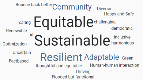 Kiera and her team of Duke students have worked through SWISLR-related papers that were associated with a social science discipline. They are working to uncover who is studying SWISLR within the social science sphere, where are SWISLR interviews and surveys taking place, how is SWISLR impacting coastal communities, and what are the means of response to SWISLR impacts. The past semester was all about extracting information from SWISLR social science research, and now the team at Duke is working on analyzing the data and synthesizing the information they worked to pull out of the literature. They specifically will be looking at what questions are being asked in these papers and surveying the surveyors to ask them what questions should be asked. To find out more about this project you can see their first semester findings described in this blog post: https://apnep.nc.gov/blog/2024/01/22/saltwater-intrusion-sea-level-rise.
Through engaging with community members, Torry has been able to create and collaborate on 4 different projects and has taken the original goal of co-creating stories of change to the next level. Torry found the original questions and goals laid out during the all-hands meeting were becoming stretched and changed based on who she was talking to and the timing of when people were able to talk. The first project is working with K-12 students to write and create resiliency fables to give the students power in their future and an outlet for their grief and worry surrounding climate change. The second project is creating a collective of people working in puppetry and climate change so as opportunities come up there is a network of people working in this sphere that can be connected to the project in question. The third project is making a documentary on farming in Princeville, a coastal North Carolina town. The farmer Torry is working with talked about their connection to the land, the changes they have made throughout their life, and the changes they will have to make in future SWISLR-induced farm fields. The last project is a short live puppet show on moving away from the coast with the intent to connect an art form to information. Although migration is a tough topic to talk about, the connection to art and puppetry is a creative way of softening some of the anxiety surrounding it. All these projects came out of the idea that stories can be a powerful tool to talk about anxieties surrounding climate change. We finished the webinar with a discussion on public spaces and factors that have facilitated safe spaces to share ideas and thoughts about climate change. You can watch the presentations and the discussion here. https://youtu.be/E924S_bvdBA For the December webinar we were joined by Henry Yeung and Dr. Justin Wright to talk about the many aspects of ghost forests. Henry Yeung is a Ph.D. candidate at the University of Virginia, studying plants and climate change using remote sensing. Dr. Justin Wright is a plat ecologist interested in uncovering the causes of ecosystem patterns. Both are interested in ghost forests.
Henry has been able to create a fairly accurate model to predict where dead trees are located based on spectral imagery from the sky. He has also been able to identify the areas that are more difficult for the model to identify. With this accuracy, he has been able to apply the model across the entire eastern coast (Virginia to New Hampshire). Using the large area of tree mortality, Henry could start identifying trends in the data. Henry has been able to identify that mortality varies strongly with elevation but differs across regions. Most mortality happens below 10 meters of sea level and the Mid-Atlantic wetlands are experiencing substantial forest mortality. Specifically, the states of Maryland, New Jersey, and Virginia are experiencing the most freshwater forest mortality. Using this model we have increased our understanding of U.S. east coast ghost forests, providing a method for other areas to do the same. Looking at ghost forests at these large scales provides us with generalizable information, however, it is potentially missing the landscape-specific changes that can cause increased or decreased forest mortality. Dr. Justin Wright has decided to create a team focused on understanding the history of places where we see these large swaths of ghost forests. In general, he has found that when researchers are trying to understand why land has been heavily impacted, our immediate thought is to the present - what are the species located there, what is the hydrology of the area, etc. But what we are seeing is the history of the landscape that is influencing trends present to this day. Therefore, a newly funded project to work with the Forest History Society will be compiling the history of coastal North Carolina which will highlight the history of the ghost forests that Henry is seeing from remote sensing. The big question now, is how do we scale up the history of landscapes impacted by SWISLR? Both projects are focused on ghost forests, and although they cover very different aspects of tree mortality, they are both focused on understanding the patterns of mortality and how we can potentially protect, or at least predict, the loss of our forested wetlands. Spencer Rhea and Alex Smith joined us to share updates on their SWISLR projects created at the All-Hands meeting this past May. Spencer started by sharing his project “S.T.E.W.P. - Salting the Earth with Purpose” (name yet to be finalized) focused on understanding how SWISLR affects carbon emissions in coastal wetlands, with a focus on how soil properties can mediate the response. Alex Smith followed up with the “G.Y.S.T.” project focused on how we can adapt ecosystem models to SWISLR field work going on and how field work can potentially be adapted to inform models. You can watch this recording posted in the SWISLR Seminars page.
As Spencer introduces his project, he shared with us that wetlands store a lot of carbon due in part to the soils that allow wetlands to hold onto the carbon for a long time. With global climate change these carbon stocks are under threat and many of our wetlands are disappearing under sea level rise. The effects of saltwater intrusion into wetlands and soils is variable and there are many different effects that can compound on each other. To gain a better understanding of SWISLR effects on soils he collected soil samples from other SWISLR RCN member’s research sites and compared the soil and chemical properties between salt exposed sites and protected sites. This project is still in the beginning stage and Spencer will investigate wetlands soils further through a “Common garden experiment” and a “Common substrate experiment”. Through this work Spencer wants to identify what soils are most resistant to SWISLR and welcomes other soil researchers to get involved in this soil examination! Alex further discusses the complexity of SWISLR impacts to ecosystems and explains how these complex interactions compounding on each other require complex and innovative models. To arrive at these innovative models we first need to understand the popular adaptable models available. Through a synthesis of adaptable terrestrial models Alex arrived at ELMs, specifically the Energy Exascale Earth System Model (E3SM), a model that simulates coupled processes and interactions among water, energy, carbon, and nutrient cycles. However, the ELM does not include detailed hydrology, ecology, or biogeochemistry - all traits that we would need for modeling SWISLR. But, this model is adaptable and modules can be added to refine the model for SWISLR. Alex talks through the modules of FATES and PFLOTRAN and their pros and cons with modeling SWISLR. The current inclusion of coastal habitats in ELM, the adaptability of ELM through modules, and the simplicity in the structure of the model make a great case for why we should use ELM to model SWISLR. In addition, field studies could better inform these models. Therefore, Alex is completing a literature review of SWISLR field studies to identify what researchers are collecting and the traits that would be important to include in a model. Studies like G.Y.S.T. and S.T.E.W.P. are helping to inform our SWISLR RCN on how we are and how we should be collecting ecosystem disturbances due to SWISLR. As we, as researchers, continue to complete experiments and collect data, there should be a concerted effort to identify and abide by a standard set of methods. One of our partner networks, the Down East Resilience Network, hosted an event to remember hurricane Florence and to take a look at how prepared Down East North Carolina is for the next big event. The community conversations started with memories of where Down East was five years ago, asking the big questions of “were we ready then?” and “are we ready for the next one?” Community members shared their concerns with the chronic flooding they are facing now, highlighting the fact that if it floods on a sunny day it will be even worse during a storm. This event brought a mix of researchers, media, elected officials and community members together to listen and talk to one another. Members from our own SWISLR RCN were there to talk about ghost forests, a ghost forest sentinel site, the sunny day flooding project, and partnership opportunities. There were multiple panels and talks to share the changes that Down East is seeing, what the potential reasons behind these changes are, and how Down East is handling these changes. Local fishers spoke on the shifts in their fishing industry, Dr. Emily Bernhardt talked about the increase of ghost forests and what they mean, and Dr. Katherine Arnade and Dr. Chris Voss talked about sea level rise and flooding. These changes people are seeing in their surroundings give insight into the reality of living so close to the edge of the ocean. One community member said that the “beauty and abundance of water define our communities.” 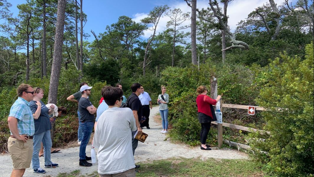 SWISLR RCN member Erin Seekamp showing off the Down East sentinel site. The next big question was “now what?”, more specifically “are we really ready for the next one and what can we do now to prepare?” To start answering these questions, the second half of the event focused on the resilience of Down East’s infrastructure and personal risk mitigation. There were two panels asking representatives from NCDOT and NCDOI what the plan is for a more resilient Down East. These two sessions had many specific questions from the community all circling the topic of what can people do to protect their homes and families. Many highlighted the issues they have with drainage ditches not controlling the flow of water away from their homes. Instead, people are finding their yards flood through this modification that was originally created for draining water.
Participating in this conversation was very insightful and rewarding. It was interesting to hear from the whole system of a coastal area - the people living there, the researchers studying there, and the managers making decisions there. New members from this resilience network have now joined our SWISLR RCN to help bring this full systems thinking to the entire North American Coastal Plain. Chris Yeomans from the Core Sound Waterfowl Museum, Jennifer Allen from Coastal Review, Kelly Garvy from lighthouse environment partners, and Isabella Thayer from NC State University. As sea level rises and saltwater intrusion grows worse, we need more collaboration and data sharing so we can move towards a resilient future smartly. Friday SWISLR webinars are happening again this school year! SWISLR Seminars will be once a month, each one focused on a project that came out of the SWISLR All-Hands meeting. Many people during the All-Hands meeting said that the SWISLR RCN can help their projects by providing connections to people or to data outside of their social network. Therefore, each project will have a chance throughout the school year to host a SWISLR Webinar and a discussion that will help further their project.
The Projects and their project leads:
For this first webinar each project got a chance to highlight what they proposed at the All-hands meeting and what has been accomplished since then. You can check out these pitches by watching the recording of this webinar on youtube. After each project lead, or project representative, introduced their project, we had breakout groups to further discuss what has been going on within the working groups. In these breakout groups people shared ideas and data sources. The S.T.E.W.P. project now has an additional soil sampling site, Stories of Change has some more people to talk to about the changes they are observing, and the SWISLR RCN has some new members joining the list serv! I am looking forward to hearing more about these projects in the coming months, and can’t wait to see what connections grow from them. At the end of last month we had our first SWISLR all-hands meeting! Many exciting projects, working groups, and connections were created at this event. The group of people that were able to join describe our time at Camp Don Lee the best: 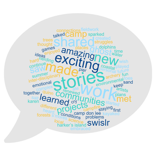 "A bunch of SWISLR enthusiasts all met up at a coastal summer camp and ate s’mores and kayaked. We played games and shared our stories. We renewed our excitement for science. We saw dolphins off the pier. We saw the ghost trees of the ghost forests. We talked out complex problems. We made new connections and Karen from Harker’s island made me cry. We came up with some really exciting new projects. We worked really hard. We learned about the struggles of local communities. We met some amazing artists. We sparked new ideas. We heard emotional stories and shared stories of our own. We started projects we will keep on working on together. We thought about salt in a lot of different places and created a SWISLR community! We embraced inter-disciplinary work and we made plans to continue this work into the future. We shared fun personal stories about fieldwork around the campfire. Enjoyed nerding out and wish there was more archery. We learned about the environmental conditions at Camp Don Lee where we were staying. Baby Quinn put her toes in the water and the sand for the first time. And it was awesome!" 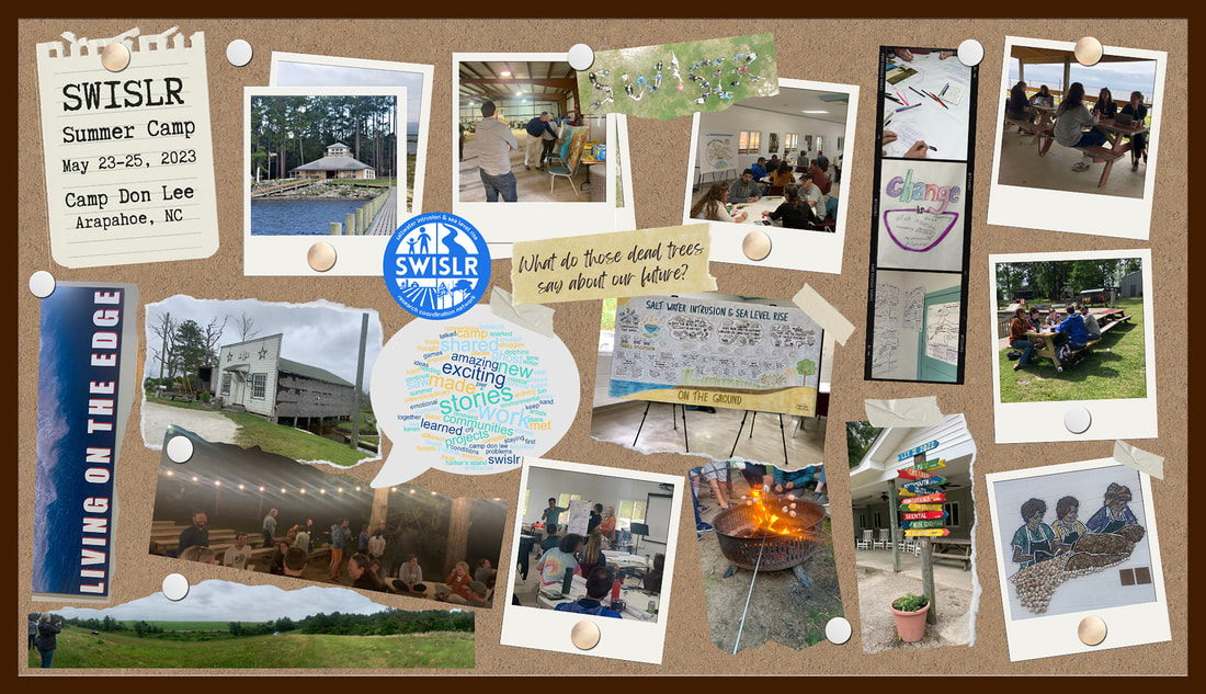 A commonality that we all share is data – if you don’t collect your own data you often use publicly available data to find information through national or regional datasets. Working with big publicly available data has introduced the need for some guiding principles in order to protect sensitive data and allow access to everyone equitably. One such set of principles are the FAIR data principles. This acronym stands for findable, accessible, interoperable, and reusable and these guidelines put emphasis on enhancing the ability of machines to automatically find and use the data, in addition to supporting its reuse by individuals. Without these pieces it is hard for data reuse to happen. Reuse is important in research because many people rely on syntheses, regional generalization, and comparing methods or results. Reuse and access is also important to community members and practitioners so they can make decisions using the best data possible. Specifically with SWISLR, FAIR data practices (https://www.go-fair.org/fair-principles/) are necessary if we want to make general statements of the issues SWISLR causes. There are really hard to solve problems happening right now, and in order to come up with resilient solutions, it is more beneficial if we can use data across regions and disciplines.
Organizations such as NSF, NASA, and journals (e.g. AGU) are creating policies where researchers are required to share their data and make the data publicly available in data repositories. There is a large landscape of data repositories available on the web that can make it harder to find the source of data you are looking for. Although they are helpful for housing data and making them publicly available, the number of repositories available can make it harder to know where to look for the data you are trying to find. There are efforts to combine these repositories as data atlases that constrain the geography or google data that houses the links to these data sources. However, they do not cover the full depth of data available on the web. Given this, Dr. Anna Braswell has asked – “How can we make data more discoverable?” One way is that we can create a centralized data repository for all data like NOAA’s National centers for environmental information (https://www.ncei.noaa.gov/) or the European Marine Observation and Data Network (https://emodnet.ec.europa.eu/en). However, this requires a lot of time, space, and money that is not readily available. Another option is to require improvements to the information included with the open data so it can be more findable for systems like google data that scrape the web for you when you search. But this takes a lot of buy in from all the repositories housing data and researchers who publish their data. Although this is doable, it will take time. Finally, one option forward is to create a community around data. To achieve this, Dr. Braswell is creating a site where people can create posts about data they use and post questions they have about data availability and useability: https://copecomet.github.io/Coastal-Data/. The goal of this data curation service is to create a community around data and help improve the ways in which we use and find data. The most recent SWISLR webinar discussed ecological system shifts throughout the NACP. Justin Wright and Aeran Coughlin introduced us to their work on plant and microbial community change in the Alligator River National Wildlife Refuge. The RCN hopes to synthesize the ecological impact of SWISLR. Existing studies are typically site-specific and species-based, limiting the possibilities for generalizations. However, a syntheses of existing studies will help determine what to expect and help develop best-practices for future coordinated research. Therefore the second half of the webinar was a discussion about what people are studying and how traits are being linked to SWISLR induced changes.
Justin Wright starts off by talking through how SWISLR is inducing changes not only along the coast but affects inland plant communities due to human alterations. Specifically in the Albemarle-Pamlico peninsula, the drainage networks allow for salt to move inland. The wright lab has looked at how plant communities have changed because of this salt incursion into the peninsula. They found that species composition has shifted to varying degrees, but were not quite sure what the causes of these changes were. There was some hint that salt and elevation was correlated to the composition shifts, however the relationships were stronger for plant-traits such as basal area (Anderson et al. 2022). These findings indicate that SWISLR is responsible for the drastic ecosystem shifts into the transient state of ghost forests that are seen throughout the NACP. However, the mechanisms of these changes is not entirely known since correlations do not prove that salt is responsible for composition changes. So, Aeran is diving deeper into these interactions to identify why plants are reacting to salt coming into the soil in the Alligator River National Wildlife Refuge. They are focusing on plant-soil interactions and have already found that the microbial soils are important for tree and shrub growth, with forest soils in the Alligator River being primed for shrub growth. Being at the start of their dissertation, Aeran has many more questions to answer and has primmed the RCN to think about how to study plant interactions moving forward. The RCN contains more than just plant ecologists, and people are thinking about many aspects of SWISLR from human land use to coastal hydrology. Most plant ecologists who were in the room said they mostly study community composition and measurements of function aren’t as prevalent. Many use indicator species (like Justin and Aeran) to identify ecosystem changes due to SWISLR but it is hard to connect species to salinity specific stress since a lot of plant trait changes are the same regardless of whether a tree is stressed by inundation or salinization. A paper by Keryn Gedan and Eduardo Fernandez-Pascual was highlighted as an example of linking plant traits to salinization. Another example of linking plant traits to salinization is Serina Wittyngham’s work at VIMS. They are curious about what constrains the lower limit of Phragmites in the salt marsh since the upper limit is better understood. They are measuring plant traits and rhizome starch content of Phragmites to see how treatments such as salt and herbicide influence the energy stores and ability for spread. You can watch the Wright lab talk and the summary of the discussion rooms on youtube. The discussions so far have been 15-30 minutes long, often cutting some connections and thoughts short. We hope you all will continue these discussion at the upcoming all-hands meeting! We took a break from the regular format of our webinars to host a Show-and-Tell! This format was to help us start talking about the 3rd theme: How are water management and climate change interacting to determine the magnitude, extent, and duration of saltwater intrusion within and across the NACP? Although we know that humans have altered the hydrology across the coastal plain, the extent to which human activities lead to variation in SWISLR impacts is not well known. Regional differences in water management practices create areas of “weird” water movement since human infrastructure can potentially constrain the natural hydrological processes through flow control technologies. Variabilities within the water infrastructure makes the interactions between water management and water harder to understand regionally. When predicting the timing, magnitude and duration of saltwater intrusion and sea level rise “bathtub” models are typically used that assume topography as the dominant driver of vulnerability. However, the coastal plain ecosystem is dependent on human decisions of water management and infrastructure. Therefore, to better understand the full impact of SWISLR we require models that integrate sea level rise, rainfall-runoff relationships, evapotranspiration, natural geomorphology, water infrastructure (canals systems, dikes, levees) and water management (pumps, check dams, irrigation, groundwater extraction). In the SWISLR Show-and-Tell we invited RCN members to tell us about the weird water where they work and live: 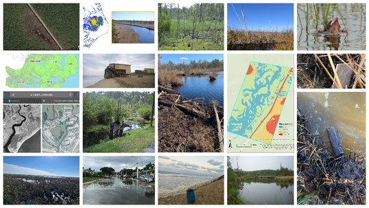 Some alternatives to photos were Ashley Helton's coastal viewer, Xi Yang's drone video, and Jean-Christophe Domec's site info. You can watch everyone's description of their photos here.
|
AuthorsKiera O'Donnell:[email protected] Archives
March 2024
Categories |
 RSS Feed
